Best Kilimanjaro acclimatization Join with Friends
- Trip Overview
- Trip Itinerary
- Similar Tours
What's included
- All meals included
- All mentioned activities
- All park entrances fees
- Medically qualified mountain guides, cooks and porters
- Oxygen Cylinder
- Professionally guided tour
- Alcoholic and soft drinks
- Entry visa for Tanzania
- Laundry Services
- Other International flights
- Personal expenses
- Services not specifically stated in the itinerary
- Tips to mountain crew
- Visa arrangements
Machame Route 6 Days Elevation Profile & Altitude Guide
Overview
Climbing Mount Kilimanjaro through the Machame Route is an incredible adventure, but understanding the altitude changes along the way is an important part of preparing for the journey. The Machame Route 6 Days Elevation Profile gives climbers a clear picture of how high they will climb each day, the distances they will cover, and the challenges they may experience as they approach the summit.
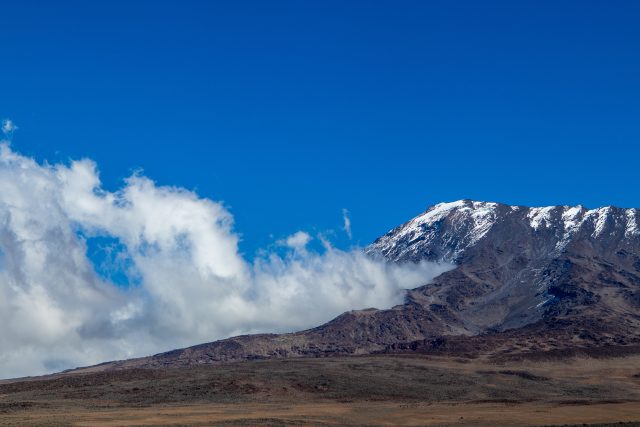
Known as the Whiskey Route, Machame is famous for its beautiful scenery, varied landscapes, and exciting mountain trails. The adventure begins at Machame Gate, approximately 1,800 meters above sea level, and takes climbers through lush rainforest, open moorland, rocky alpine desert, and eventually the icy summit of Uhuru Peak at 5,895 meters.
What makes this route special is how dramatically the surroundings change as the altitude increases. One day, climbers are walking beneath tall rainforest trees, and a few days later, they are surrounded by volcanic rocks and sweeping views above the clouds.
The six-day itinerary is physically demanding, particularly because it includes fewer days for acclimatization than the seven-day option. However, with good preparation, experienced mountain guides, and careful attention to altitude symptoms, climbers can approach the adventure with greater confidence.
Machame Route 6 Days Tour Facts
| Tour Information | Details |
|---|---|
| Mountain | Mount Kilimanjaro |
| Route | Machame Route |
| Duration | 6 Days / 5 Nights |
| Starting Point | Machame Gate |
| Starting Elevation | Approximately 1,800 m |
| Highest Point | Uhuru Peak – 5,895 m |
| Finishing Point | Mweka Gate |
| Total Trekking Distance | Approximately 62–65 km |
| Difficulty Level | Challenging |
| Accommodation | Mountain camping tents |
| Best Climbing Months | January–March and June–October |
| Recommended Fitness | Good physical fitness |
Machame Route 6 Days Elevation Profile
Before beginning the climb, it helps to understand how the elevation changes from one campsite to another. Some days involve steady uphill walking, while others include both climbing and descending to help the body adjust to higher altitudes.
| Day | Trekking Route | Overnight Elevation |
|---|---|---|
| Day 1 | Machame Gate to Machame Camp | 2,835 m |
| Day 2 | Machame Camp to Shira Camp | 3,750 m |
| Day 3 | Shira Camp via Lava Tower to Barranco Camp | 3,960 m |
| Day 4 | Barranco Camp to Barafu Camp | 4,673 m |
| Day 5 | Barafu Camp to Uhuru Peak and Mweka Camp | 3,100 m |
| Day 6 | Mweka Camp to Mweka Gate | 1,640 m |
Note: These elevations are approximate. Actual readings can vary slightly depending on the campsite location and GPS measurements.
Understanding the Elevation Changes on Machame Route
One of the most fascinating things about climbing Kilimanjaro is how quickly the environment changes with altitude.
At the beginning of the journey, the air feels warmer and the forest is full of vegetation. As climbers move higher, the trees gradually disappear, temperatures fall, and the landscape becomes increasingly rocky and exposed.
Above 4,000 meters, even simple activities can feel more demanding because less oxygen is available with each breath. This is why walking slowly, taking regular breaks, and listening to the mountain guides are so important.
The Machame Route includes a helpful acclimatization section at Lava Tower, where climbers reach a higher altitude before descending to sleep at Barranco Camp.
Altitude Sickness and Acclimatization on Machame Route
Altitude sickness is something every Kilimanjaro climber should understand, regardless of age, fitness level, or previous hiking experience.
As the climb progresses, the reduced oxygen availability can make breathing more difficult and physical activity more tiring. Some trekkers may experience headaches, nausea, dizziness, tiredness, or difficulty sleeping.
These symptoms should never be ignored. Climbers must tell their guides immediately if they feel unwell, particularly when symptoms worsen.
A few practical habits can help support a safer climb:
- Walk slowly rather than rushing uphill.
- Drink water regularly and avoid dehydration.
- Eat enough food to maintain energy.
- Get as much rest as possible between hiking days.
- Avoid alcohol during the trek.
- Report headaches, nausea, dizziness, or unusual fatigue.
- Follow the mountain guide’s health and safety instructions.
- Discuss preventive altitude medication with a qualified healthcare professional before departure.
Best Time to Climb the 6 Days Machame Route
Kilimanjaro can be climbed throughout the year, although weather conditions vary considerably between seasons.
The most popular climbing periods are January to March and June to October, when conditions are generally drier and visibility can be better.
| Months | Typical Weather Conditions |
|---|---|
| January–March | Often relatively dry, with cold summit temperatures |
| April–May | Heavier rainfall and muddy trails |
| June–October | Generally drier, with cool mountain temperatures |
| November–December | Variable weather with periods of rainfall |
Why Choose Kilinge Adventures for Your Machame Route Climb?
Climbing Kilimanjaro is about more than reaching the summit. It is about experiencing the mountain, discovering beautiful landscapes, and sharing an adventure with people who understand the journey.
At Kilinge Adventures, we aim to make every climbing experience well-organized, enjoyable, and focused on safety.
- Knowledgeable local mountain guides familiar with the Machame Route.
- Carefully planned trekking itineraries.
- Guidance on altitude awareness and acclimatization.
- Camping arrangements and mountain support.
- Assistance with packing and climb preparation.
- Private and group climbing options.
- Friendly support throughout the mountain adventure.
Frequently Asked Questions
How high does the Machame Route 6 Days climb?
The route reaches Uhuru Peak at 5,895 meters above sea level, the highest point on Mount Kilimanjaro and in Africa.
What is the starting elevation of Machame Route?
The climb begins at Machame Gate, approximately 1,800 meters above sea level.
Is the Machame Route 6 Days difficult?
Yes. The six-day itinerary is challenging because of its steep sections, significant elevation gains, and limited time for acclimatization.
What is the highest campsite on the Machame Route?
Barafu Camp is the highest overnight camp on the standard six-day Machame itinerary, at approximately 4,673 meters.
Why do climbers visit Lava Tower?
Lava Tower provides an opportunity to spend time at a higher elevation before descending to Barranco Camp. This climb-high, sleep-low approach can help with acclimatization.
How much elevation is gained on summit day?
Climbers gain approximately 1,222 meters between Barafu Camp and Uhuru Peak.
Can beginners climb the six-day Machame Route?
Beginners with good physical fitness can attempt the route, but the seven-day option is usually more suitable because it provides additional time for acclimatization.
Does good fitness prevent altitude sickness?
No. Even experienced and physically fit climbers can develop altitude sickness. Proper acclimatization and attention to symptoms are essential.
Book Your Machame Route 6 Days with Kilinge Adventure
The Machame Route offers an unforgettable journey from the green rainforest at the foot of Kilimanjaro to the extraordinary heights of Uhuru Peak.
Along the way, every climb brings a new landscape, every campsite offers a different view, and every day becomes part of a memorable mountain experience.
Plan your Kilimanjaro climb with Kilinge Adventures and discover the beauty, challenges, and excitement of the Machame Route with experienced local mountain guides.
Book this Tour with Kilinge Adventures
Apart from this, you may read and write some reviews for us from Safari Bookings.
Also, you may read and write reviews for us from TripAdvisor
- Day 1
- Day 2
- Day 3
- Day 4
- Day 5
- Day 6
Machame Gate to Machame Camp
The surroundings are green, peaceful, and full of life. Tall trees, thick vegetation, and the sounds of birds make this first section especially enjoyable. Lucky hikers may even spot monkeys moving through the forest canopy.
Although the trail starts gently, the elevation increases steadily throughout the day. By the time climbers arrive at Machame Camp, they will have gained more than 1,000 meters in altitude. It is a good opportunity to begin practicing a slow, comfortable walking pace.
Daily Elevation and Trekking Details
- Starting Elevation: 1,800 m
- Ending Elevation: 2,835 m
- Elevation Gain: 1,035 m
- Trekking Distance: Approximately 11 km
- Hiking Time: 5–7 hours
- Vegetation Zone: Rainforest
Machame Camp to Shira Camp
This section is steeper than the first day, so climbers may find themselves stopping occasionally to catch their breath and admire the scenery. On clear days, the views of Mount Meru in the distance are particularly impressive.
As the trail approaches Shira Camp, the air becomes noticeably cooler and thinner. Reaching an altitude of approximately 3,750 meters is an important milestone, and climbers should pay close attention to how their bodies are responding.
Daily Elevation and Trekking Details
- Starting Elevation: 2,835 m
- Ending Elevation: 3,750 m
- Elevation Gain: 915 m
- Trekking Distance: Approximately 5 km
- Hiking Time: 4–6 hours
- Vegetation Zone: Moorland
Shira Camp to Lava Tower and Barranco Camp
The morning begins with a gradual ascent across the rocky landscape toward Lava Tower, a striking volcanic formation standing at approximately 4,630 meters. By this point, climbers are experiencing a much higher altitude than on the previous days.
After reaching Lava Tower, the route descends toward Barranco Camp, located at approximately 3,960 meters. Along the way, the landscape changes again, with impressive valleys, unusual giant groundsels, and magnificent views of Kilimanjaro's southern slopes.
This day follows the important climb-high, sleep-low principle. Spending time at a higher elevation before sleeping lower can support acclimatization, although it does not eliminate the risk of altitude sickness.
Daily Elevation and Trekking Details
- Starting Elevation: 3,750 m
- Highest Point: Lava Tower – 4,630 m
- Ending Elevation: 3,960 m
- Ascent to Lava Tower: Approximately 880 m
- Descent to Barranco Camp: Approximately 670 m
- Trekking Distance: Approximately 10 km
- Hiking Time: 6–8 hours
- Vegetation Zone: Alpine Desert
Barranco Camp to Barafu Camp
Despite its intimidating appearance, the wall is generally a scramble rather than a technical rock climb. Guides help climbers navigate the rocky sections carefully, and reaching the top rewards everyone with spectacular mountain views.
From there, the trail continues through Karanga Valley before climbing toward Barafu Camp. This is where the six-day itinerary becomes particularly demanding. Unlike the seven-day Machame Route, there is no overnight stop at Karanga Camp, so climbers continue directly to Barafu.
By the time the group reaches camp, the altitude is approximately 4,673 meters. The afternoon and evening are spent resting, eating, checking equipment, and preparing for the summit attempt, which usually begins around midnight.
Daily Elevation and Trekking Details
- Starting Elevation: 3,960 m
- Ending Elevation: 4,673 m
- Net Elevation Gain: 713 m
- Trekking Distance: Approximately 9 km
- Hiking Time: 7–10 hours
- Vegetation Zone: Alpine Desert
Barafu Camp to Uhuru Peak and Mweka Camp
The adventure usually begins around midnight. Wearing warm clothing and headlamps, climbers slowly make their way uphill through the darkness. The air is cold, the path is steep, and every step requires patience and determination.
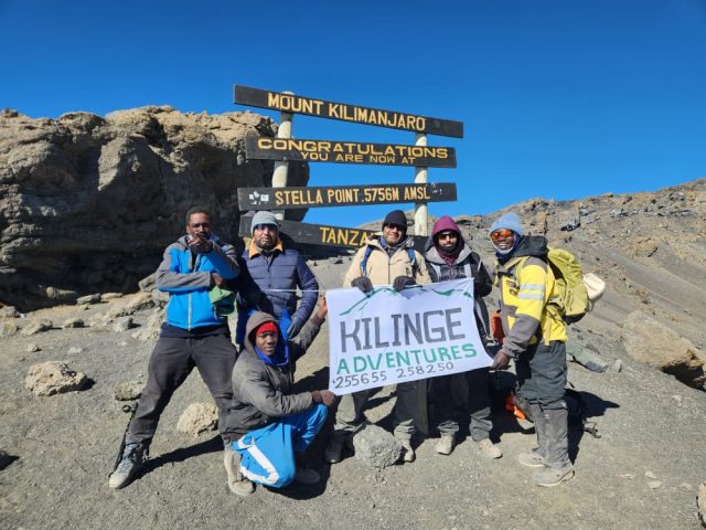
As the group approaches Stella Point, the first signs of sunrise may begin to appear over the horizon. From there, the final stretch leads toward Uhuru Peak, the highest point in Africa at 5,895 meters.
Standing at the summit is an unforgettable experience. On a clear morning, climbers can admire the surrounding glaciers, distant landscapes, and incredible views from the Roof of Africa.
After spending a short time at the summit, the descent begins. Climbers return toward Barafu Camp for a break before continuing down to Mweka Camp, where the warmer air and lower elevation provide welcome relief.
This is the longest and most physically demanding day of the trek, and the summit attempt must always be guided by weather conditions and each climber's health.
Daily Elevation and Trekking Details
- Starting Elevation: 4,673 m
- Summit Elevation: 5,895 m
- Elevation Gain to Summit: 1,222 m
- Ending Elevation: Approximately 3,100 m
- Total Descent from Summit: Approximately 2,795 m
- Trekking Distance: Approximately 17 km
- Hiking Time: 12–16 hours
- Vegetation Zones: Arctic Summit, Alpine Desert, and Moorland
Mweka Camp to Mweka Gate
Following breakfast, the group begins the final descent through the rainforest toward Mweka Gate. The trail can be slippery, especially after rainfall, so careful footing is still important.
Along the way, there is time to reflect on the journey, enjoy the forest scenery, and celebrate the experience with fellow climbers and the mountain crew.
Upon reaching Mweka Gate, the climbing adventure officially comes to an end. Eligible climbers receive certificates recognizing the highest summit point they reached before returning to Moshi or Arusha.
Daily Elevation and Trekking Details
- Starting Elevation: 3,100 m
- Ending Elevation: 1,640 m
- Elevation Loss: 1,460 m
- Trekking Distance: Approximately 10 km
- Hiking Time: 3–4 hours
- Vegetation Zone: Rainforest